|
|
|
THE WATER |
 |
|
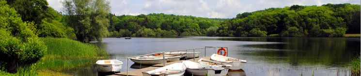
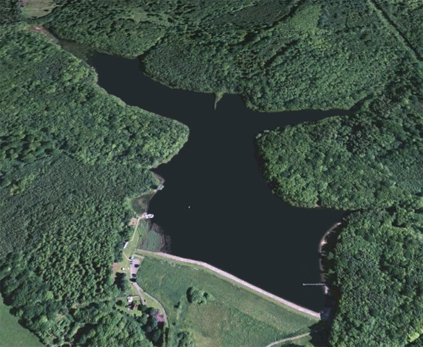
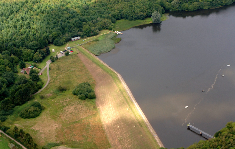
Powdermill Reservoir is located 1.2 miles to the north-east of Sedlescombe and 1.4 miles west of Broad Oak. The 56 acre
reservoir has been stocked with high quality rainbow trout and also has a good head of wild brown trout which should be returned when caught. The water
has been leased by The Hastings Fly Fishers Club Ltd since 1932. We believe that Powdermill is the most beautiful water in the south-east with quality fishing to match.
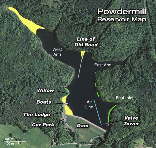

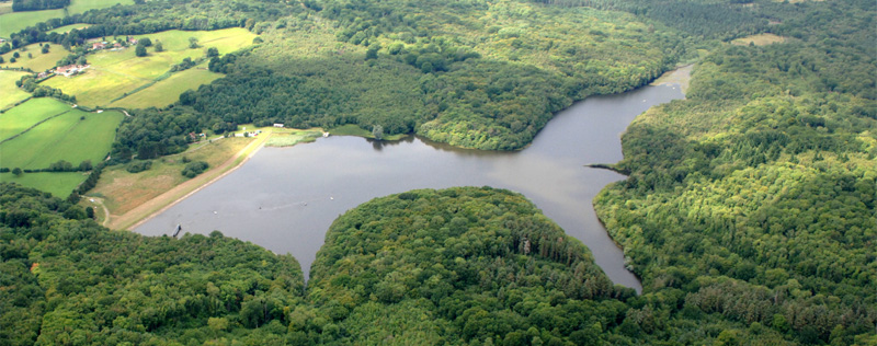
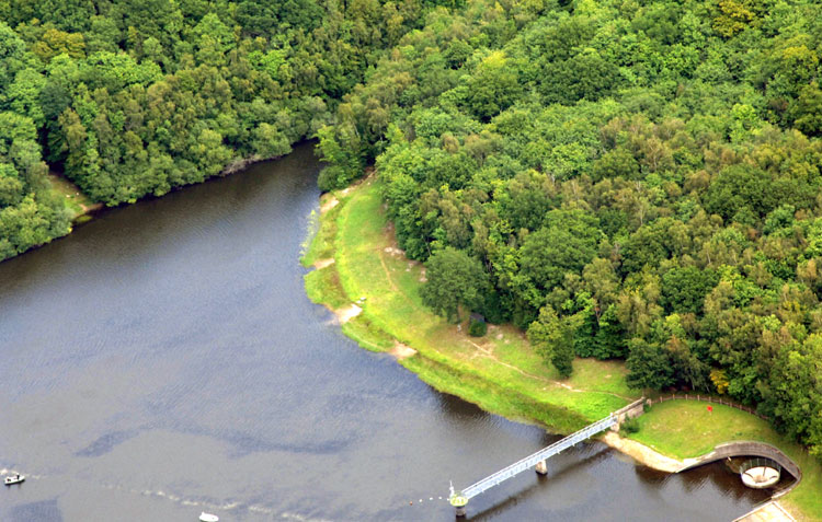
As can be seen from the aerial views, the reservoir is surrounded by dense woodland. Hastings Fly
Fishers control the 100 metres around the reservoir which belongs to Southern Water.
The bank to the east of the dam was originally also heavily wooded down to the water, but over the years this has been cleared and now provides excellent fishing and also the
opportunity to wade out a short distance. Please bear in mind that only thigh waders should be used as wading out farther can be very dangerous.
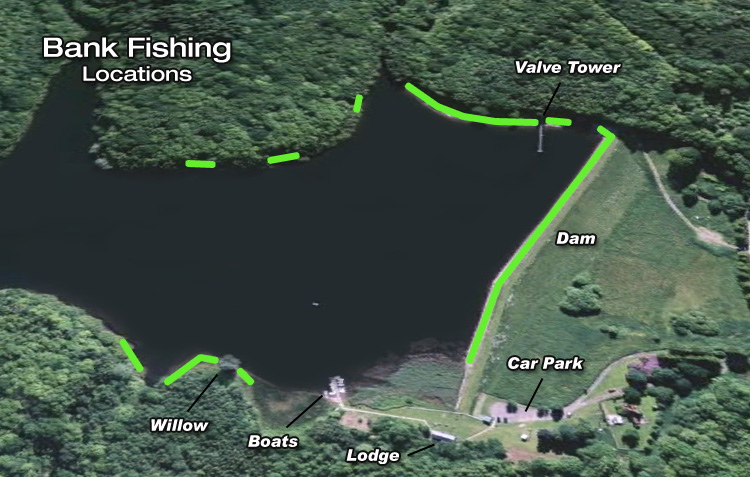
At the northern end of the east bank there is an inlet which is where water can be pumped-in from the river Brede. To get to the three cut-outs past the inlet you will need to follow
the path back into the woods a little way before you can cross the inlet stream. The first cut-out in the woods faces the dam and can be a very productive spot. Further round, you
will find two more cut-outs facing west which give access to relatively deep water in an area otherwise only available to boats. There is no opportunity to bank fish past the third
cut-out as the trees and bushes are very dense, down to the water’s edge.
The area around the Valve Tower is the deepest part and is a popular location for both boat and bank anglers.
Boats can easily access all parts of the reservoir, but boat anglers should not get within 50 metres of any bank fisher or within 50 metres of the dam. |
|
Reservoir Depth
and Locations
The maximum water depth, to be found off the Valve Tower, is thirty five feet and still reaches nearly thirty feet at the centre of the Dam from where there
is a shallow gradient up towards the Club House.
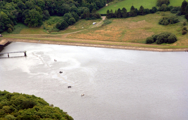
The Dam is approximately 400 metres long and is provided with wooden stages along its length to give a flat level staging from which to fish. The dam wall slopes
down very steeply and any form of wading is strictly prohibited. Care should be taken, especially
in wet weather, as the surface can become slippery. The dam is
the most popular location for bank fishermen as fish often patrol along the dam within easy casting distance.
The East Bank, adjacent to the dam, initially has a gentle slope but then drops to over twenty feet of water for most of its length. Having been cleared this area
provides easy casting and can often be very productive relatively close in.
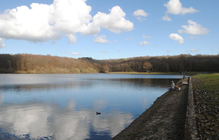
The East Inlet is where water from the River Brede is pumped into the Reservoir whenever the river level is high enough. During the summer the flow of slightly cooler
water will attract some fish into the inlet. The early morning angler shown here is fishing the extreme end of the inlet in the hope of catching such fish.
The water along the West Bank, past the fishing lodge and the boat jetty, is mainly shallow with a gradual slope leading to depths varying between seven and twelve feet, but
there is one steeper drop in front of the willow tree and great care should be taken if wading near here. Bank fishing from the willow tree is a favourite spot for bank
anglers, particularly if the fish are in this area as they can often be close in to the shore in the deep gully.
The West Arm to the north of the reservoir is much shallower starting (from the old road) at around twelve feet and although it maintains a reasonable depth throughout most
of its length, it is very shallow as you approach the far end and gets heavily weeded in the summer. However, fishing at the far end can be very productive. The old road
itself lies between six and eight feet deep with a drop either side to around twelve feet on the West arm side and nineteen feet on the other. When levels are extremely
low the old road separates the West Arm from the main body of the reservoir. However, the road has two deeper channels cut through it to allow water flow and fish movement.
The shorter East Arm, at the north end of the reservoir, runs from nineteen feet down to about six feet and is very narrow and care has to be taken not to spook the fish.
|
|
Reservoir Level
Powdermill Reservoir provides 95% of the water used in the Hastings area. It stores more than a billion litres of water.
View the current level
Capacity:
1,060 megalitres
(1,060,000,000 litres)
|
|
Bank Fishing
Bank fishing is limited to, the dam, the east bank adjacent to the dam, the three "cut-outs" in the woods past the east bank, and the area either side of the willow tree on the west bank.
Click on an Image to Enlarge |
|
|
The Aerator at Powdermill
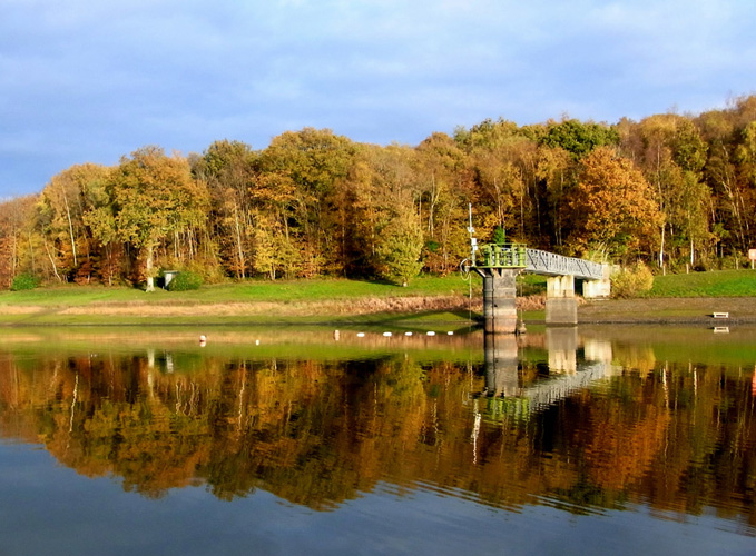
The air line (bubbler) enters the water at the far eastern end of the dam and follows the line of greatest depth past the valve tower
heading down towards the centre of the reservoir. The centre of the reservoir is largely flat forming a "pan" that tips slightly towards the dam and the East bank.
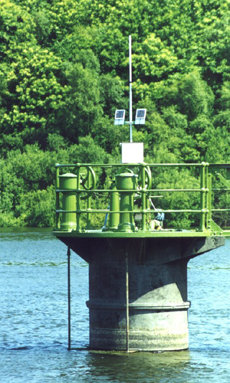
Southern Water have recently upgraded the Aerator at Powdermill replacing the, manually controlled, diesel compressors with an electric compressor. The new system is
fully automatic with a control system fitted to the valve tower (top) which monitors the water temperature and sends radio commands to the compressor (bottom). The
control system is powered by a pair of photo electric panels and has cables with transducers fitted that hang below the water surface. In comparison to the diesels
the electric system is almost inaudible, a fact that is greatly appreciated in the bailiff's cottage some two hundred yards away, and the complete absence of fumes
is another benefit.
The solar powered sensing and control system fitted to the Valve Tower. The twin photocell arrays can be seen on either side of the radio mast. The temperature transducers
monitor the water temperature and send control signals to the air compressor once a certain temperature is reached.
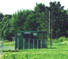
The green building, at the end of the car park next to the path to the fishing lodge, houses the electric compressor and control equipment for the aerator. A three phase
transformer powers the compressor. A radio mast, attached to the side of the green building, links the compressor to the sensing equipment located on the Valve Tower.
The whole system has proved to be reasonably quiet and efficient in operation as well as completely automatic and produces an amazing amount of air which stirs up the
water. Unfortunately, the entire system can be temperamental and is likely to trip for no apparent reason. Although we can contact Southern Water, if it
inadvertently
switches off, they do not necessarily rush to switch it back on. Sometimes it is advantageous not to have it on as fish, in certain
conditions, can tend to congregate
and feed along the line of water disturbance rather than be found in all parts of the reservoir. At other times, when the water
temperature rises, the added aeration
is positively beneficial. However, more often the aeration makes little difference to where the fish happen to be or where they are feeding. |
|
 |